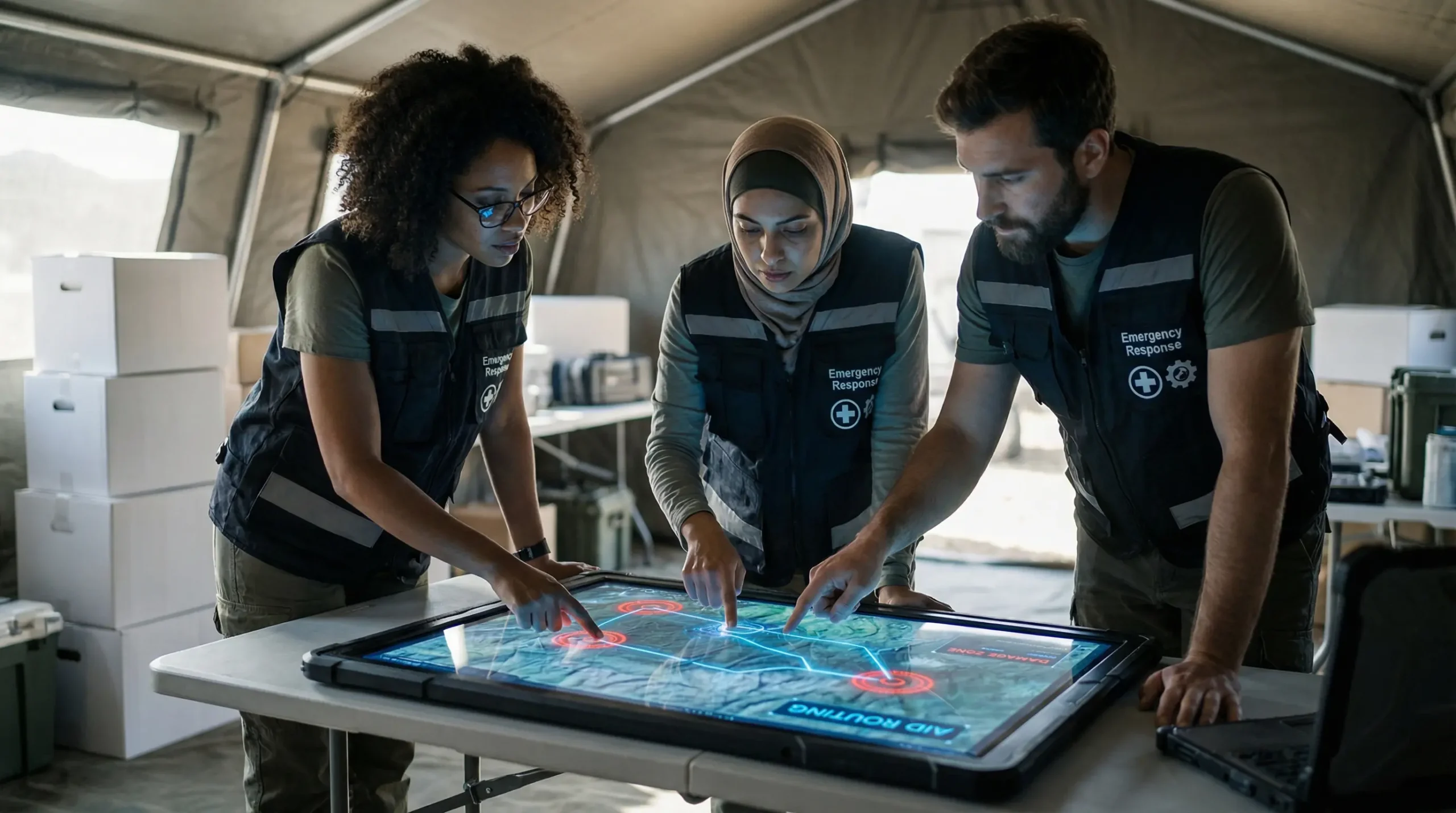
🌍 In 2026, 239 million people need urgent humanitarian assistance — and AI is now operational across every phase of crisis response, from flood prediction weeks in advance to satellite damage assessment within hours of a disaster. This guide covers real deployments, the ethical guardrails that matter, and the tools organizations are using on the ground.
Last Updated: June 6, 2026
AI in crisis management has moved from pilot program to operational infrastructure in 2026. OCHA’s Global Humanitarian Overview 2026 reports that 239 million people require urgent humanitarian assistance this year — with wars in Sudan, Gaza, and Ukraine displacing millions, climate emergencies intensifying in frequency and severity, and two famines unfolding simultaneously for the first time in recorded history. Against this backdrop of unprecedented humanitarian need and constrained funding, AI is not a futuristic aspiration. It is the technology that determines whether a flood warning reaches a vulnerable community 72 hours before an event or 12 hours too late, whether post-earthquake damage assessment takes days or hours, and whether supply chains reach the right location with the right resources or sit stranded in a logistics bottleneck. The humanitarian organizations and emergency management agencies that have deployed AI effectively are demonstrating measurable outcomes — in lives reached, resources optimized, and response time compressed.
This guide covers the complete picture of AI in crisis management and humanitarian aid as of 2026: how AI maps onto each phase of the crisis lifecycle, which real-world deployments have produced documented results between 2023 and 2026, the tools and platforms organizations are using on the ground, and — critically — the ethical guardrails that humanitarian professionals and policy researchers rightly demand before any AI system is deployed in a context where lives are at stake. The humanitarian sector has a sophisticated and hard-won understanding of the principle of “do no harm” — and applying it to AI systems requires specific frameworks that go well beyond standard technology ethics. For government and public sector readers, our guide to AI in government and public services covers the institutional governance context that frames many of these deployments.
The 2026 humanitarian AI landscape is defined by three simultaneous dynamics: expanding capability (AI models can now process satellite imagery, sensor data, social media signals, and structured databases simultaneously to generate actionable crisis intelligence in near real-time), expanding deployment (UN agencies, Red Cross, WFP, and national emergency management agencies are operationalizing AI at scale rather than piloting it narrowly), and expanding ethical urgency (a 2024 UN University study found that nearly 70% of humanitarian agencies using AI lacked a formal ethical framework — a gap that creates genuine risk for the displaced persons and crisis-affected populations those systems are meant to help). Understanding all three dynamics is necessary for anyone working at the intersection of technology and humanitarian response in 2026.
📖 New to AI terminology? Visit the AI Buzz AI Glossary — 65+ essential AI terms explained in plain English, each linking to a full in-depth guide.
📅 1. AI Across the Crisis Lifecycle — 4 Phases
Crisis management professionals think in phases — and organizing AI’s role by phase is the most practical way to understand where technology is adding genuine value versus where it remains aspirational. The four-phase lifecycle — Preparedness, Response, Relief, and Recovery — each presents distinct information needs, time pressures, and data challenges. AI’s strengths map differently onto each phase, and the tools and techniques appropriate at each stage differ significantly. The table below provides the structured overview; the sections that follow go deeper on the phases where AI is producing the most documented impact in 2026.
| Crisis Phase | What AI Does | Example Application | Key Organizations Using It |
|---|---|---|---|
| Preparedness | Predictive risk modeling from historical climate, seismic, and socioeconomic data; early warning system generation; resource pre-positioning based on risk probability forecasts; vulnerability mapping of exposed populations | Google Flood Hub predicts riverine flooding up to 7 days ahead across 100+ countries using ML hydrological models, covering 460 million people globally as of 2025 | Google Flood Hub; WFP Hunger Map LIVE; FAO GIEWS; World Bank GFDRR; ECMWF / Global Flood Awareness System (GloFAS) |
| Response | Rapid damage assessment from satellite and drone imagery; survivor detection from search and rescue sensor data; missing person tracking; evacuation route optimization; resource allocation from real-time need signals | Maxar Open Data Program releases pre- and post-event satellite imagery within hours of major disasters; AI models classify building damage into four severity categories, compressing field survey timelines from days to hours | Maxar/Vantor; Planet Labs; Esri ArcGIS Disaster Response; ICRC Trace the Face; US FEMA; Copernicus Emergency Management Service |
| Relief | Supply chain optimization and logistics routing; real-time translation and multilingual communication for displaced populations; volunteer coordination and task matching; disease surveillance and outbreak detection from syndromic signals | UNHCR uses machine translation for refugee documentation processing; WFP uses AI-driven supply chain models to optimize food distribution routing across conflict-affected supply corridors | UNHCR; WFP; ICRC; MSF (Médecins Sans Frontières); WHO EIOS disease surveillance; IRC |
| Recovery | Infrastructure damage mapping and rebuilding prioritization; multi-source needs assessment synthesis; population displacement tracking; economic impact modeling; family reunification from biometric and documentation data | ICRC’s Trace the Face uses facial recognition and AI matching to reunite families separated by conflict and disasters; Esri ArcGIS used for recovery mapping in post-earthquake Turkey (2023) and Moroccan Atlas earthquake (2023) | ICRC; World Bank; UNDP; Esri / ArcGIS; national recovery agencies; UN Satellite Centre (UNOSAT) |
The phase-based view reveals a pattern that is not obvious from the tool marketing: AI’s most mature and reliable deployments in 2026 are concentrated in Preparedness (early warning systems, risk modeling) and the initial Response phase (satellite imagery analysis, resource routing). These are high-volume, data-rich stages where pattern recognition and optimization deliver measurable advantages over purely manual approaches. The Relief and Recovery phases involve more complex human judgment requirements — cultural sensitivity, community trust, accountability for decisions — where AI augments rather than leads, and where the ethical considerations are most acute. The Copernicus Emergency Management Service (CEMS), a joint European Commission and ECMWF initiative, exemplifies the current maturity level: it includes both the European Flood Awareness System (EFAS) and Global Flood Awareness System (GloFAS), delivering probabilistic flood forecasts at European and global scale by integrating meteorological forecasts with hydrological models for actionable early warnings. Systems like GloFAS demonstrate what scaled, institutionalized AI early warning looks like — but also remind us that approximately one in three people globally still lacks access to adequate multi-hazard early warning systems, representing both the gap AI must help close and the equity challenge it must not worsen.
The 2026 Humanitarian AI Reality: AI is moving the timeline on crisis response from reactive to anticipatory. Google Flood Hub’s ML-based flood prediction, covering 460 million people across 100+ countries, issues warnings up to 7 days ahead — giving communities and responders time to act before floodwaters arrive rather than after. The World Economic Forum estimates that early warning systems can reduce disaster mortality by 30% and economic damage by up to 6x the investment. AI is the technology making those systems scalable and global.
🌍 2. Real AI Deployments in Crisis Response — 2023–2026
The most important distinction between a general AI article and a genuinely useful resource for humanitarian professionals is the presence of documented, real-world deployments with specific outcomes. The examples below are all operational or have produced documented results between 2023 and 2026. They are framed accurately as of June 2026 — noting where specific data points represent the state of knowledge at the time of publication and where outcomes are partial or evolving.
Satellite Imagery AI: Maxar Open Data Program and the 2023 Türkiye-Syria Earthquakes
The February 2023 Türkiye-Syria earthquake sequence — one of the deadliest disasters in the region’s modern history — became a defining test case for AI-assisted satellite damage assessment in humanitarian response. Following the earthquake, the Maxar Open Data Program released high-resolution pre- and post-event satellite imagery of the affected region within hours of the event. Researchers at multiple institutions applied deep learning damage assessment models to this imagery, classifying building damage across thousands of blocks in the Antakya, Gaziantep, and Kahramanmaras regions into four severity categories: No Damage, Minor Damage, Major Damage, and Destroyed. The AI-assisted assessment process — which would have required days of manual field survey to cover equivalent geographic scope — was completed in hours, providing response teams with a prioritized damage map they could use to direct search and rescue resources toward the highest-concentration destruction zones before ground teams could assess conditions manually. The research demonstrated accuracy levels that validated against government field data, establishing that AI satellite damage assessment at this resolution is operationally reliable for disaster response decision support.
Planet Labs’ fleet of medium- and high-resolution satellites provides daily Earth observation coverage that humanitarian organizations use for ongoing disaster monitoring at temporal scales that were impossible with earlier satellite systems. Planet’s imagery has been applied to damage and environmental impact assessment following floods, volcanic eruptions, and wildfires — providing the high-temporal-resolution coverage that makes change detection possible at disaster speed rather than on satellite revisit cycles measured in days or weeks. Google’s Geospatial Reasoning research effort, launched in 2025 with Maxar and Planet Labs as initial participants, represents the next generation of this capability: combining Google’s foundation models for remote sensing with Gemini’s reasoning capability to move from raw imagery to actionable intelligence — estimating the fraction of buildings damaged per neighborhood, projecting property damage values from census data, and suggesting relief effort prioritization based on social vulnerability indices. As of 2026, this capability is in the trusted tester program phase — not yet at full operational deployment — but represents the near-term trajectory for AI-integrated geospatial crisis response.
AI Early Warning Systems: Google Flood Hub and GloFAS
Flood prediction is the AI application in crisis management with the largest documented reach as of 2026. Edge AI and sensor networks feed into centralized prediction systems that process meteorological, hydrological, and topographic data continuously. Google Flood Hub, which uses machine learning models trained on historical hydrological data from river gauges and satellite observations, now covers over 100 countries and issues flood forecasts up to 7 days ahead — providing a dramatically larger warning window than traditional deterministic flood models that operate on 24–48 hour horizons. The system covers approximately 460 million people in its forecast zone as of 2025, and has been specifically designed to address a critical gap: the areas most at risk from flooding are often the least well-served by traditional ground-based hydrological monitoring networks, because they are in low- and middle-income countries where the dense gauge networks required for traditional forecasting do not exist. Google’s ML approach fills data gaps by using satellite observations and global atmospheric reanalysis data, making probabilistic flood prediction viable in data-scarce regions where it was previously impossible.
The Global Flood Awareness System (GloFAS), developed through collaboration between the European Commission and ECMWF (European Centre for Medium-Range Weather Forecasts), represents the institutional complement to Google’s system: a global-scale probabilistic flood forecast integrated into the Copernicus Emergency Management Service’s operational warning infrastructure. GloFAS processes ensemble weather forecasts with hydrological river routing models to produce global flood forecasts at 5-day and seasonal timescales — providing the medium-range and seasonal outlook that national civil protection agencies use for resource pre-positioning and preparedness planning. The combination of systems like GloFAS (institutional, government-integrated) and Google Flood Hub (digital-access, population-facing) represents the layered early warning architecture that the UN’s “Early Warnings for All” initiative is working to complete globally by 2027.
UNHCR Machine Translation and Documentation Processing
UNHCR — the UN Refugee Agency — operates across 135 countries providing protection and assistance to over 117 million forcibly displaced people as of mid-2025. The documentation and registration requirements for displaced persons — asylum applications, protection documentation, resettlement processing, legal identity verification — involve enormous volumes of multilingual text, often in low-resource languages that standard commercial translation tools handle poorly. UNHCR has deployed machine translation systems to support registration and documentation workflows, helping caseworkers communicate with displaced persons in their own languages and process documentation more quickly than purely manual translation workflows allow. The Children’s Immunization App (CIMA), deployed in settings including the Zaatari refugee camp, uses AI to track vaccination schedules and send automated reminders to parents — demonstrating AI’s application to health infrastructure within humanitarian settings. These deployments are not replacing human caseworkers; they are enabling caseworkers to serve more people, in more languages, with greater consistency — which in a context of chronic UNHCR underfunding and overwhelming caseload, represents a real operational gain.
WHO Disease Surveillance and Outbreak Detection
The World Health Organization’s Event Information Site (EIS) and the Epidemic Intelligence from Open Sources (EIOS) platform use AI-assisted natural language processing to monitor global news, social media, and official reports for disease outbreak signals — detecting emerging public health threats before formal notification through official surveillance channels. This epidemiological intelligence function is particularly valuable in humanitarian contexts, where disease outbreaks — cholera, measles, acute watery diarrhea — are a leading secondary cause of mortality in displaced populations. AI screening of open-source signals compresses the time between first appearance of outbreak indicators and mobilization of public health response, giving organizations like MSF and IRC earlier warning to pre-position medical supplies and personnel. AI’s role in this surveillance function is explicitly as a signal processor and triage tool — human epidemiologists review AI-flagged signals before any formal public health response is initiated.
🏭 Exploring AI in your industry? Browse the AI Buzz Industry Guide — 35+ in-depth sector guides covering how AI is transforming healthcare, finance, HR, legal, retail, manufacturing, and more.
⚖️ 3. Ethical Guardrails for AI in Humanitarian Contexts
The ethical stakes of AI in humanitarian contexts are categorically higher than those in most other domains. When an AI-assisted recommendation determines which neighborhood receives search and rescue resources first, which refugee’s documentation is processed faster, or whether a flood warning is issued in time for a community to evacuate — the consequences of failure are not measured in revenue loss or customer dissatisfaction. They are measured in lives. A 2024 UN University study found that nearly 70% of humanitarian agencies using AI lacked a formal ethical framework — a figure that represents both the urgency of the problem and the immaturity of humanitarian AI governance relative to the speed of deployment. The ethical analysis below is not theoretical. These are the live tensions humanitarian professionals navigate in operational AI deployments right now.
Algorithmic Bias and Resource Allocation Inequity
AI systems in crisis management learn from historical data — and historical data reflects historical inequities. If past disaster responses systematically underserved remote communities, marginalized ethnic groups, or populations with less political visibility, an AI system trained on that historical response data will reproduce and potentially amplify those patterns in future resource allocation recommendations. The Harvard Humanitarian Initiative has specifically warned that even minor data distortions in humanitarian AI can translate into major humanitarian inequalities — because the stakes in resource-constrained crisis environments are existential rather than commercial. A biased recommendation engine in a commercial context may cause a suboptimal product suggestion. A biased resource allocation model in a famine response may mean a remote community does not receive food aid in time. Researchers have documented geographic bias in humanitarian AI specifically: overrepresentation of Global North contexts in training data produces models that perform well in data-rich environments and poorly in the data-scarce, crisis-prone environments of the Global South — exactly where the systems are most needed and where errors are most costly. The corrective action required is not passive: it requires intentional data diversity efforts, ongoing bias auditing of AI outputs in the field, and community participation in defining the objectives that AI systems are optimizing for. For the governance structures that enable this kind of accountable AI deployment, our guide to building an AI governance framework provides the policy-building toolkit.
Data Privacy for Displaced Persons and Refugees
Data privacy for crisis-affected populations is not a compliance exercise — it is a protection issue. Displaced persons and refugees are among the most data-vulnerable populations in the world. They often lack the legal standing to exercise data rights, the digital literacy to understand consent implications, or the power to refuse data collection that is tied to access to essential services (food, shelter, healthcare). When humanitarian organizations collect biometric data, health records, or location information for legitimate operational purposes — needs assessment, registration, aid targeting — that data becomes a target. Misinformation and surveillance risks compound in conflict contexts where state actors have interests in identifying and locating specific population groups. The Rohingya crisis of 2017 provided a documented example of the risk: biometric data collected by UNHCR for aid distribution purposes was shared with government authorities without refugee consent — data that could have enabled the identification of individuals who faced violence based on their ethnic identity. This case established a precedent that humanitarian organizations have worked to address with stronger data governance since, but the structural vulnerability remains: any dataset about crisis-affected populations that exists is a potential surveillance instrument if control of it is lost. AI systems that aggregate multiple data streams about displaced populations — location, health, documentation, behavior — concentrate this risk in particularly powerful ways. The principle of data minimization — collecting only what is necessary for the specific operational purpose — is the primary ethical control, and it applies with greater force in humanitarian AI contexts than in virtually any other domain.
Accountability, the “Do No Harm” Principle, and Humanitarian Principles
The four fundamental humanitarian principles — humanity, neutrality, impartiality, and independence — provide the ethical architecture within which humanitarian organizations operate. AI systems can conflict with each of these principles if deployed without careful governance. Neutrality requires that humanitarian organizations not take sides in hostilities — but AI systems trained on data from one conflict party may have embedded assumptions that compromise neutral analysis. Impartiality requires that aid be delivered based on need alone — but AI optimization systems that maximize operational efficiency can inadvertently de-prioritize the hardest-to-reach populations whose needs are greatest. Independence requires that humanitarian action be autonomous from political considerations — but AI systems sourced from large technology companies based in countries with political interests in conflict zones create dependency relationships that can compromise that independence. Liability when AI-assisted decisions cause harm is a specific accountability gap in humanitarian AI that has not been resolved. When an AI early warning system fails to issue a timely alert and a community is not evacuated — who is accountable? The organization that deployed the system? The technology provider? The individual operator who relied on the AI output? Humanitarian organizations are increasingly clear on one principle in response: AI can support decisions, but must never replace human judgment in consequential determinations about assistance and protection. The human-in-the-loop requirement for all consequential AI-assisted decisions in humanitarian contexts is not a governance aspiration — it is the professional consensus across the major humanitarian organizations as of 2026. Physical AI systems such as delivery drones in humanitarian contexts add further dimensions to this accountability question, as their deployment in conflict-adjacent environments creates additional safety and attribution challenges that organizations are actively working to govern.
The “Do No Harm” Standard for Humanitarian AI in 2026: OCHA defines AI in humanitarian work as “a force for good only when it enhances, not replaces, human judgment.” The ethical deployment standard emerging across the humanitarian sector requires: informed consent where feasible; data minimization and purpose limitation; bias auditing before and after deployment; human override capability at all decision points; and public accountability for AI-assisted decisions affecting crisis-affected populations. 70% of humanitarian agencies currently using AI lack a formal ethical framework — closing that gap is the sector’s most urgent AI governance priority in 2026.
🛠️ 4. Tools and Platforms Used in Humanitarian AI
The tools deployed in operational humanitarian AI fall into six functional categories: geospatial intelligence, predictive analytics, natural language processing, communication and translation, physical sensing (drones and IoT), and coordination platforms. The landscape in 2026 has matured beyond proof-of-concept: major platforms now offer humanitarian pricing tiers, and the UN has invested in building interoperable data infrastructure — including OCHA’s Humanitarian Data Exchange (HDX) and the UN Satellite Centre (UNOSAT) — that makes AI tools more applicable across organizations. The table below covers the primary tools in operational use as of June 2026.
| Use Case | Tool / Platform | Used By | Key Capability |
|---|---|---|---|
| Post-disaster satellite damage assessment | Maxar/Vantor Open Data Program | FEMA, UNDAC, Team Rubicon, research institutions, national civil protection agencies | Pre/post event high-resolution satellite imagery released within hours of disaster activation; AI building damage classification into four severity levels |
| Ongoing Earth observation for disaster monitoring | Planet Labs | WFP, FAO, UNHCR, UNOSAT, national disaster management agencies | Daily global satellite coverage with AI-powered vegetation, flood, and change detection analytics; NDVI drought monitoring |
| Geospatial analysis and recovery mapping | Esri ArcGIS (Disaster Response Program) | Red Cross, UN agencies, FEMA, national emergency agencies; free access under Esri Disaster Response Program | GIS mapping for damage assessment, evacuation routing, infrastructure recovery prioritization; integrates satellite, sensor, and crowdsourced data |
| Flood prediction and early warning | Google Flood Hub; ECMWF GloFAS | National hydrological agencies, civil protection authorities, WFP anticipatory action programs; Google Flood Hub accessible to general population | ML-based flood forecasting up to 7 days ahead (Google Flood Hub, 100+ countries); probabilistic global flood forecasts for medium-range operational response (GloFAS) |
| Predictive analytics and crisis intelligence | IBM Environmental Intelligence Suite; WFP HungerMap LIVE | WFP, FAO, national governments, disaster risk management agencies | AI-powered extreme weather forecasting, climate risk modeling; WFP HungerMap monitors food security across 90+ countries using ML on 40+ data streams in near real-time |
| Translation and multilingual communication | Google Translate API; Microsoft Azure AI Translator; UN iTranslate | UNHCR, ICRC, IRC, MSF, national registration authorities | Machine translation for refugee registration documentation, field communications, and crisis messaging across 100+ languages; low-resource language support improving rapidly |
| Disease outbreak surveillance | WHO EIOS (Epidemic Intelligence from Open Sources) | WHO, national public health agencies, MSF, UNICEF | AI-powered NLP monitoring of global news, social media, and official reports for early disease outbreak signal detection; multi-language coverage |
| Drone reconnaissance and delivery | DJI Enterprise (AI-assisted inspection); Zipline (medical delivery) | WHO (last-mile medical supply delivery), national disaster management agencies, field survey teams | Aerial survey of inaccessible disaster zones; Zipline’s autonomous drone delivery deployed for medical supplies in Rwanda, Ghana, and Nigeria; AI-assisted route optimization for hard-to-reach areas |
Tool status as of June 2026. Humanitarian organizations should verify current data governance and privacy terms for each platform before deployment with crisis-affected populations. Esri’s Disaster Response Program provides free emergency access to ArcGIS during declared disasters.
The technology picture that emerges from this table is one of genuine maturity in specific capability areas — satellite imagery analysis, flood prediction, translation, disease surveillance — and continued development in areas like coordination platforms and field data integration. The common constraint across nearly all humanitarian AI deployments is not the technology itself but the data infrastructure that feeds it: standardized, interoperable, high-quality datasets about populations, needs, and resources are the prerequisite for any AI system to deliver reliable outputs. OCHA’s Humanitarian Data Exchange (HDX) has made important progress on data standardization across the sector, but significant gaps remain — particularly in data coverage for conflict-affected settings where traditional data collection is most difficult and humanitarian need is most acute. For the governance framework that sits above these technical tools, our guide to AI governance for organizations provides the policy structure that humanitarian organizations need to deploy these tools responsibly.
🏁 5. Conclusion: Building Responsible Humanitarian AI Capacity in 2026
AI in crisis management and humanitarian aid in 2026 is a story of real, documented capability alongside real, unresolved ethical complexity. The satellite imagery AI that compressed post-earthquake damage assessment from days to hours in Türkiye, the flood prediction systems issuing warnings 7 days ahead to 460 million people, the machine translation tools enabling UNHCR caseworkers to serve displaced persons in their own languages — these are concrete contributions to humanitarian outcomes that did not exist at this scale five years ago. They are working now, in operational deployments, and the organizations that have invested in building the data infrastructure, governance frameworks, and human capacity to use these tools responsibly are demonstrably more effective than those that have not.
The ethical urgency is equally real. The 70% of humanitarian agencies using AI without formal ethical frameworks is not an abstract governance gap — it is a live risk to the displaced persons, refugees, and crisis-affected populations those systems are meant to serve. The principles that guide responsible humanitarian AI in 2026 — data minimization, bias auditing, human override capability, purpose limitation, accountability for consequences — are not aspirational standards. They are the operational requirements for deploying AI in contexts where algorithmic errors have life-and-death consequences. The humanitarian sector’s hard-won understanding of “do no harm” — developed through decades of difficult experience — is the most important lens through which AI adoption in this domain must be evaluated. Technology companies, NGOs, and government actors working in humanitarian AI in 2026 that understand this principle, and build it into their systems architecture from the beginning rather than retrofitting it afterward, are the ones building tools that will genuinely serve the 239 million people who need urgent humanitarian assistance this year.
📌 Key Takeaways
| ✅ | Takeaway |
|---|---|
| ✅ | 239 million people need urgent humanitarian assistance in 2026 (OCHA Global Humanitarian Overview 2026) — the combination of climate emergency escalation, active conflicts, and constrained funding makes AI-assisted crisis response not optional but operationally necessary. |
| ✅ | Google Flood Hub’s ML-based system issues flood warnings up to 7 days ahead across 100+ countries, covering approximately 460 million people — the WEF estimates early warning systems reduce disaster mortality by 30% and generate economic returns of up to 6x the investment. |
| ✅ | Post-earthquake satellite damage assessment using AI (demonstrated in the 2023 Türkiye-Syria earthquake response with Maxar imagery) compressed field survey timelines from days to hours, providing prioritized building damage maps to response teams before ground assessment was physically possible. |
| ✅ | AI’s most mature humanitarian deployments in 2026 are in Preparedness (early warning, risk modeling) and initial Response (satellite damage assessment, resource routing). The Relief and Recovery phases involve more complex human judgment requirements where AI augments rather than leads. |
| ✅ | A 2024 UN University study found that nearly 70% of humanitarian agencies using AI lacked a formal ethical framework — the sector’s most urgent AI governance gap given that algorithmic bias in resource allocation, data privacy failures for displaced persons, and accountability gaps when AI-assisted decisions cause harm all carry life-and-death consequences. |
| ✅ | Data privacy for refugees and displaced persons is a protection issue, not a compliance exercise — the 2017 Rohingya crisis demonstrated the lethal consequences of biometric data collected for humanitarian purposes being shared with state actors without consent. Data minimization is the primary ethical control. |
| ✅ | OCHA’s consensus: AI can support humanitarian decisions but must never replace human judgment in consequential determinations about assistance and protection. Human-in-the-loop capability at all consequential AI-assisted decision points is the professional standard across major humanitarian organizations in 2026. |
🔗 Related Articles
- 📖 AI in Government and Public Services: How AI Is Improving Citizen Support and Service Delivery
- 📖 Physical AI Explained: How Robots, Drones, and Smart Machines Use AI
- 📖 AI Liability and Autonomous Agents: Who Is Responsible When the Machine Makes a Mistake?
- 📖 Edge AI Explained: How AI Works Without the Internet
- 📖 AI Governance Explained: How to Build an AI Policy Framework
❓ Frequently Asked Questions: AI in Crisis Management and Humanitarian Aid
1. How is AI used in disaster response in 2026?
AI is operational across four crisis phases in 2026. In Preparedness: ML-based early warning systems like Google Flood Hub predict floods up to 7 days ahead across 100+ countries. In Response: satellite imagery AI compresses post-disaster damage assessment from days to hours, as demonstrated in the 2023 Türkiye earthquake response using Maxar data. In Relief: UNHCR uses machine translation for refugee documentation; WFP uses AI supply chain optimization. In Recovery: ICRC’s Trace the Face platform uses AI to reunite families separated by conflict. Our AI in government and public services guide covers the institutional governance context for many of these deployments.
2. What are the ethical risks of AI in humanitarian aid?
Three risks are most critical. First, algorithmic bias in resource allocation: AI trained on historically inequitable response data may reproduce and amplify those inequities, disadvantaging remote or marginalized communities. Second, data privacy for displaced persons: biometric and health data collected for humanitarian purposes can be repurposed for surveillance — the 2017 Rohingya crisis is the documented case study. Third, accountability gaps: when AI-assisted decisions cause harm, responsibility is often unclear between the deploying organization and technology provider. Our AI liability and autonomous agents guide covers accountability frameworks in depth.
3. What satellite AI tools are used for disaster damage assessment?
The Maxar/Vantor Open Data Program and Planet Labs are the two primary satellite imagery providers for humanitarian damage assessment. Maxar releases pre- and post-event imagery within hours of major disaster activations, free to response teams. AI models applied to this imagery classify building damage into four severity categories across thousands of buildings in hours rather than days. Esri ArcGIS (available free to humanitarian organizations under the Disaster Response Program) provides the geospatial analysis layer. Google’s Geospatial Reasoning framework — combining Earth observation with Gemini reasoning — is in the trusted tester phase as of 2026. Our edge AI guide explains how sensor networks feed these satellite systems.
4. Which organizations are leading AI deployment in humanitarian contexts?
The leading organizations as of 2026 are: UNHCR (machine translation for refugee documentation; CIMA vaccination tracking in camps), WFP (HungerMap LIVE food security monitoring; AI supply chain optimization), WHO (EIOS disease outbreak surveillance), ICRC (Trace the Face family reunification), UNOSAT/UN Satellite Centre (damage mapping), and Esri/Planet Labs/Maxar for geospatial tools. National civil protection agencies in the EU use GloFAS for operational flood forecasting. For the governance structures these organizations need, see our AI governance guide.
5. Can AI replace human judgment in crisis response decisions?
No — and the humanitarian sector’s professional consensus is explicit on this point. OCHA defines AI in humanitarian work as valuable only when it enhances, not replaces, human judgment. Human-in-the-loop capability at all consequential decision points — which populations receive aid, which areas are prioritized for rescue, which individuals receive protection documentation — is the operational standard across major humanitarian organizations in 2026. The accountability gap when AI-assisted decisions cause harm remains unresolved, reinforcing the necessity of human oversight. The human-in-the-loop explained guide covers how to design these oversight frameworks.
📧 Get the AI Buzz Weekly Digest
Weekly AI insights, tools, and strategies — delivered every Monday. Free.




Leave a Reply